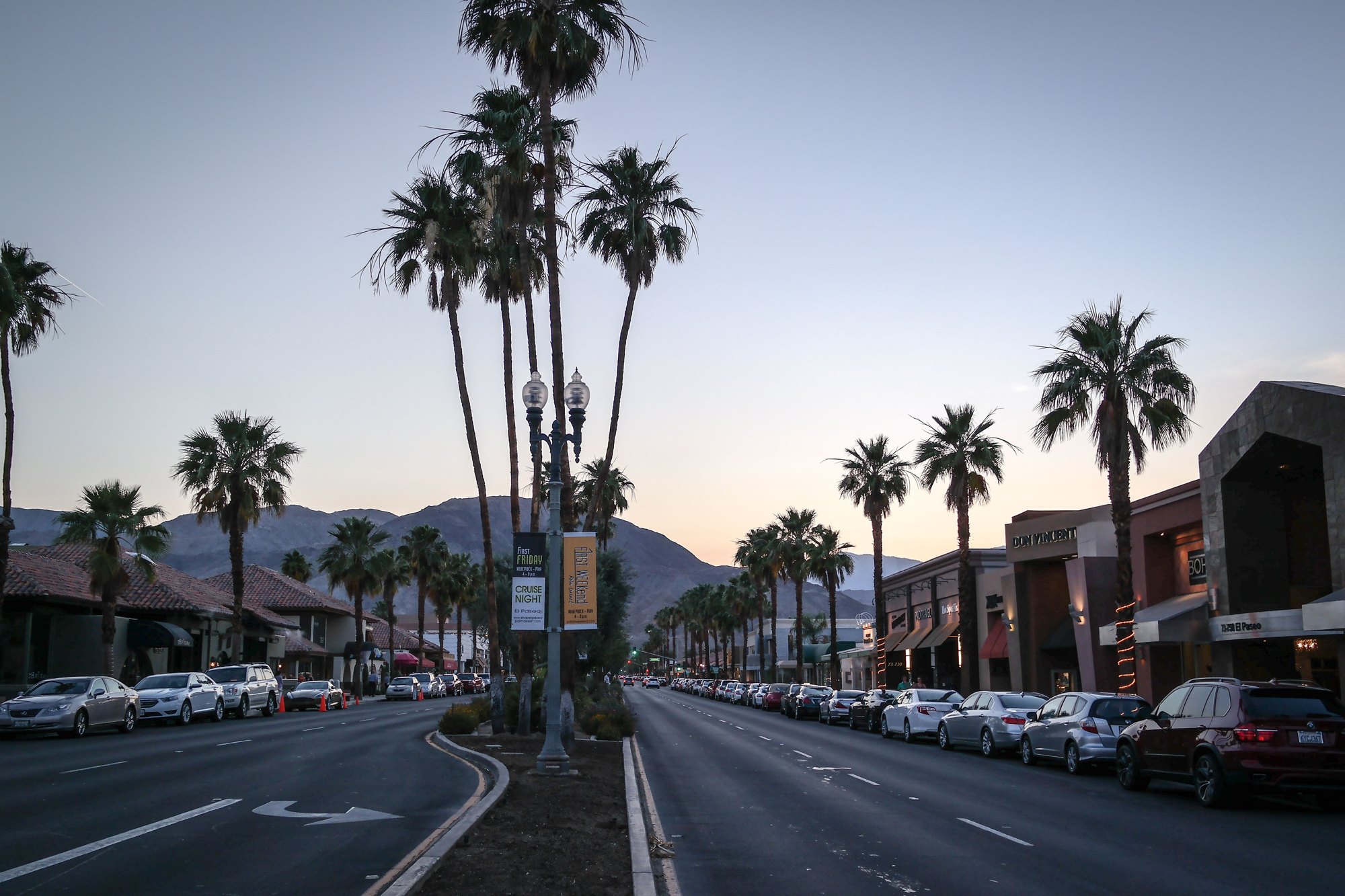
El Paseo in Palm Desert

Outdoors

Camping near Palm Desert

Campgrounds and camping areas near Palm Desert on federal land, with which ones take reservations on Recreation.gov.

Good to know: Popular campgrounds book up months ahead on Recreation.gov; first-come sites fill early on weekends and holidays.

Within 30 miles (20)

8 mi southeast · Bureau of Reclamation

Lake Cahuilla

Surronded by the stark beauty of the Santa Rosa Mountains, Lake Cahuilla (pronounced Kah-wee-ah) is a favorite recreation area in the Coachella Valley.

  • Camping
  • Fishing
  • Hiking
  • Horseback riding
  • Picnicking
  • Recreational Vehicles
  • Water sports

11 mi southwest · USDA Forest Service · Campground

Pinyon Flat Campground

Pinyon Flat is an 18-site first-come first-served campground located within the Santa Rosa and San Jacinto Mountains National Monument.

  • Camping

11 mi southwest · USDA Forest Service · Campground

Ribbonwood Equestrian Cg

Ribbonwood is an ideal mountain escape for equestrian campers. The campground overlooks Palm Desert and the Salton Sea in southern California and provides visitors with access to hundreds of miles of terrain for exploration and enjoyment.

  • Camping
  • Fishing
  • Horse Camping
  • Horseback riding
  • Mountain Biking

15 mi southeast · Bureau of Land Management

Santa Rosa Wilderness

The terrain within the Santa Rosa Mountains Wilderness is rugged with elevations rising dramatically from just above sea level to 7,000 feet.

  • Camping
  • Hiking
  • History
  • Horseback riding
  • Hunting
  • Photography
  • Wilderness
  • Wildlife viewing

21 mi west · USDA Forest Service · Campground

Fern Basin

The picturesque Fern Basin Campground is a perfect escape from a busy lifestyle. It provides peace and quiet in the mountains of southern California as well as access to countless recreational opportunities.

  • Camping
  • Fishing
  • Hiking
  • Horseback riding
  • Lookout Tower
  • Mountain Biking

21 mi west · USDA Forest Service · Campground

Marion Mountain

The Marion Mountain Campground offers a beautiful retreat in the San Bernardino National Forest. It provides access to a number of hiking trails that lead to some of the most spectacular views of Southern California.

  • Biking
  • Camping
  • Fire Lookouts/Cabins Overnight
  • Fishing
  • Hiking
  • Horseback riding

22 mi west · USDA Forest Service · Campground

Black Mountain (San Bernardino)

Black Mountain Road is is poor condition at this time. 4 Wheel Drive is recommended. The road is currently a high-priority for maintenance, which should be occuring in June, 2023.

  • Camping
  • Climbing
  • Fire Lookouts/Cabins Overnight
  • Fishing
  • Hiking
  • Picnicking

22 mi northeast · National Park Service · Campground

Ryan Campground

Download the NPS app prior to visiting the park – trail maps and more! Ryan Campground lies amid the huge, steep rock formations for which Joshua Tree National Park is known.

  • Camping
  • Hiking
  • Rock Climbing
  • Scenic Drive
  • Wildlife viewing

23 mi west · USDA Forest Service · Campground

Boulder Basin

Black Mountain Road is is poor condition at this time. A four-wheel drive (4WD) vehicle is recommended with a minimum ground clearance of 6 inches. Drive at your own risk.

  • Backpacking
  • Biking
  • Camping
  • Fishing
  • Hiking
  • Horseback riding
  • Mountain Biking
  • Picnicking

24 mi north · National Park Service · Campground

Black Rock Campground

Download the NPS app prior to visiting the park – trail maps and more! Black Rock Campground lies among one of the thickest Joshua tree forests in Joshua Tree National Park.

  • Camping
  • Hiking
  • Ranger programs
  • Wildlife viewing

24 mi north · National Park Service · Campground

Black Rock Equestrian Campground

Download the NPS app prior to visiting the park – trail maps and more! Black Rock Horse Campground is strictly for campers planning to bring horses or mules .

  • Camping
  • Hiking
  • Ranger programs
  • Wildlife viewing

24 mi east · Bureau of Land Management

Mecca Hills Wilderness

The Mecca Hills Wilderness now contains a total of 26,242 acres and is managed by the BLM's Palm Springs-South Coast Field Office . All of the Wilderness is in the state of California.

  • Camping
  • Hiking
  • Photography
  • Picnicking
  • Wilderness
  • Wildlife viewing

24 mi northeast · National Park Service · Campground

Sheep Pass Group

Download the NPS app prior to visiting the park – trail maps and more! Sheep Pass Group Campground is centrally located within Joshua Tree National Park in Southern California and is easily accessible to hiking trails and rock climbing…

  • Camping
  • Climbing
  • Hiking
  • Picnicking

26 mi northeast · National Park Service · Campground

Jumbo Rocks Campground

Download the NPS app prior to visiting the park – trail maps and more! Jumbo Rocks Campground lies amid the huge, steep rock formations for which Joshua Tree National Park is known.

  • Camping
  • Climbing
  • Hiking
  • Ranger programs
  • Wildlife viewing

28 mi southwest · Bureau of Land Management

Beauty Mountain Wilderness

The Beauty Mountain Wilderness encompasses a total of 15,627 acres and is managed by the BLM's Palm Springs-South Coast Field Office .

  • Camping
  • Hiking
  • Horseback riding
  • Photography
  • Wilderness

28 mi northeast · National Park Service · Campground

Indian Cove Group

Download the NPS app prior to visiting the park – trail maps and more! Indian Cove Campground lies amid the huge, steep rock formations for which Joshua Tree National Park is known.

  • Amphitheater
  • Camping
  • Evening Programs
  • Hiking
  • Ranger Station
  • Rock Climbing

28 mi northwest · Bureau of Land Management

San Gorgonio Wilderness

This wilderness is part of the eastern slope of the San Bernardino Mountains with topography rapidly changing from low, rolling foothills and canyons to steep, rugged mountains. Elevations range from 2,300 to 5,500 feet.

  • Camping
  • Hiking
  • Horseback riding
  • Hunting
  • Photography
  • Wilderness
  • Wildlife viewing

28 mi northwest · Bureau of Land Management

Sand to Snow National Monument

Remember your OUTDOOR ETHICS when enjoying your public lands. Please RECREATE RESPONSIBLY.

  • Accessible Swimming
  • Camping
  • Fishing
  • Hiking
  • Horseback riding
  • Photography
  • Wildlife viewing
  • Winter sports

29 mi east · Bureau of Land Management

Orocopia Mountains Wilderness

The western boundary of the Orocopia Mountains Wilderness is contiguous with the Mecca Hills Wilderness with the exception of the Meccacopia Jeep Trail, which bisects the two wilderness areas.

  • Camping
  • Hiking
  • Horseback riding
  • Hunting
  • Photography
  • Wilderness
  • Wildlife viewing

30 mi northeast · National Park Service · Campground

Indian Cove Campground

Download the NPS app prior to visiting the park – trail maps and more! Indian Cove Campground lies amid the huge, steep rock formations for which Joshua Tree National Park is known.

  • Backpacking
  • Camping
  • Evening Programs
  • Hiking
  • Picnicking
  • Ranger Station
  • Rock Climbing

30 to 75 miles (10)

31 mi southwest · USDA Forest Service · Campground

Indian Flats Campground

17 sites. Pacific Crest Trail Access. No Water. The nearest water can be found at the Warner Springs Gas Station.

  • Camping
  • Hiking
  • Picnicking
  • Recreational Vehicles

32 mi east · National Park Service · Campground

Cottonwood Campground (Ca)

Download the NPS app prior to visiting the park – trail maps and more! Cottonwood Campground is one of the best places in Joshua Tree National Park for stargazing and wildflower viewing.

  • Camping
  • Hiking
  • Ranger programs
  • Wildlife viewing

32 mi east · National Park Service · Campground

Cottonwood Group

Download the NPS app prior to visiting the park – trail maps and more! Cottonwood Group Campground is one of the best places in Joshua Tree National Park for stargazing and wildflower viewing.

  • Camping
  • Hiking
  • Picnicking
  • Ranger programs

33 mi northeast · National Park Service

Joshua Tree National Park

Two distinct desert ecosystems, the Mojave and the Colorado, come together in Joshua Tree National Park. A fascinating variety of plants and animals make their homes in a land sculpted by strong winds and occasional torrents of rain.

  • Biking
  • Camping
  • Climbing
  • Hiking
  • Horse Camping
  • Horseback riding
  • Picnicking
  • Wildlife viewing

43 mi north · Bureau of Land Management

Bighorn Mountain Wilderness

The north-central portion of this Wilderness area holds the rugged Bighorn Mountains and the eastern foothills of the San Bernardino Mountains.

  • Camping
  • Hiking
  • Horseback riding
  • Hunting
  • Nature education
  • Photography
  • Ranger programs
  • Wildlife viewing

47 mi east · Bureau of Land Management

Bradshaw Trail Back Country Byway

The first road across Riverside County to the Colorado River was blazed by William Bradshaw in 1862 as an overland stage route.

  • Camping
  • History
  • Horseback riding
  • Hunting
  • Off Road Vehicle Trails
  • Off-highway vehicles
  • Wildlife viewing

56 mi south · Bureau of Land Management

Fish Creek Mountains Wilderness

The Fish Creek Mountains Wilderness now contains a total of 21,388 acres and is managed by the Bureau of Land Management. All of the Wilderness is in the state of California.

  • Camping
  • Hiking
  • Photography
  • Wilderness
  • Wildlife viewing

57 mi northwest · USDA Forest Service

San Bernardino National Forest

  • Biking
  • Camping
  • Climbing
  • Fishing
  • Hiking
  • Horse Camping
  • Horseback riding
  • Hunting

59 mi north · Bureau of Land Management

Johnson Valley OHV Area

Click here for the latest information concerning upcoming military training and closures of the Shared Use Area. Overview Johnson Valley is a varied landscape for the off-highway vehicle driver.

  • Biking
  • Camping
  • Hiking
  • Horseback riding
  • Hunting
  • Photography
  • Recreational Vehicles
  • Wildlife viewing

63 mi south · USDA Forest Service

Cleveland National Forest

  • Biking
  • Camping
  • Hiking
  • Horse Camping
  • Horseback riding
  • Off-highway vehicles
  • Picnicking
  • Ranger programs

Distances are straight-line miles from downtown Palm Desert. Listings come from Recreation.gov’s federal recreation database; check each official page for hours, fees, fire restrictions and closures before you go.

More outdoors near Palm Desert

Questions

Where is the closest place for camping near Palm Desert?

Lake Cahuilla (Bureau of Reclamation), about 8 miles southeast of Palm Desert as the crow flies. Next are Pinyon Flat Campground (11 mi) and Ribbonwood Equestrian Cg (11 mi).

When is the best time for camping near Palm Desert?

Based on Palm Desert’s average highs, November–March. Conditions at higher elevations can be much cooler.

Can I reserve a campsite near Palm Desert?

14 of the 30 places listed here take reservations on Recreation.gov; others are first come, first served.

Who manages these places?

Federal agencies including Bureau of Land Management, National Park Service, USDA Forest Service. Each listing links to its official page for hours, fees, closures and current conditions.

Palm Desert AI

Your Palm Desert local guide
Hey there!

I'm Palm Desert AI. Ask about neighborhood food, independent shops, local history or planning a visit.

AI recommendations may be inaccurate. Verify hours and prices. Questions are processed by Cloudflare. Privacy